More than turn-by-turn navigation

Connect your vehicle, understand the road ahead, share your journey and talk to Ghost. Explore the features available in the iOS beta and the hardware we’re developing.

Camera alerts without starting navigation

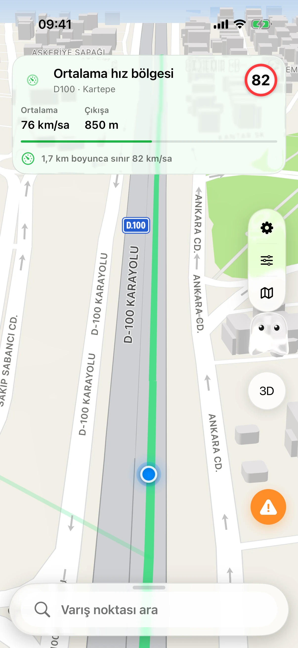
Passive Radar shows fixed cameras and average-speed zones on the road ahead. Within a zone, your average speed appears alongside the limit and the distance remaining.

  • Fixed-camera alerts
  • Average-speed tracking
  • Distance to the end of the zone
Average-speed zone on the D100 in Kartepe

Charging stops that fit your route

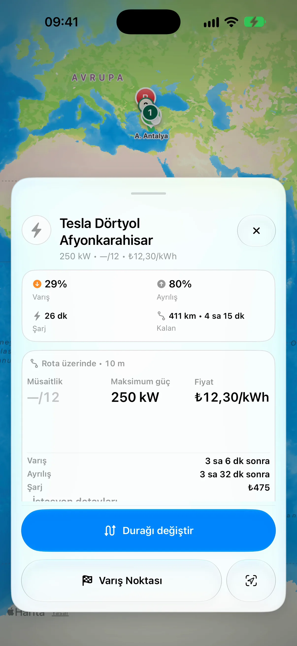
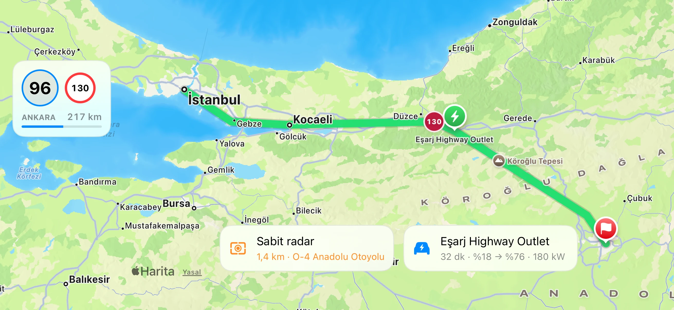
Orontes Drive uses your battery level to plan charging stops along your route. Check each station’s connectors and charging power, with an estimate of how much charge you’ll have at your destination.

  • Compatible connectors
  • Estimated charging time
  • Battery level on arrival
Tesla Dörtyol Afyonkarahisar: charging power and price

Directions where you need them

Follow your route on CarPlay, or glance at your iPhone’s Lock Screen or Dynamic Island for the next turn.

  • See your route, camera locations and planned charging stops on the car’s screen.
  • Check the next turn and time remaining with your phone locked.
  • Keep the next instruction visible when you switch to another app.
CarPlay
CarPlay

How we score a charging station

The stars on a station are the Orontes score, from 0 to 100. It weighs what matters when you pull in to charge. When a signal is uncertain, such as old live data or few reports, it counts for less and the score moves toward neutral.

Charging speed for your car

The largest factor. Power is compared with what your vehicle can actually take, and a slow site’s whole score is scaled down, so a cheap, free 22 kW post can’t outrank a fast charger.

Chance of a free plug

Free compatible sockets in the latest live data, how many sockets the site has, and how fresh that data is.

Price

Your connector’s price per kWh compared with current prices across Türkiye, when the operator publishes one.

Driver reports

Recent reports lower the score for a while: broken for 7 days, slow for 1 day, busy for 6 hours. Likes and dislikes count only once at least three different drivers have reacted.

Measured power

Where at least three sessions from vehicles that share energy data were recorded there, the power those cars actually received and how often sessions failed move the score slightly.

Site and access

More sockets mean a backup if one is taken. Sites with restricted access score a little lower than public ones.

Amenities

DC and fast stations with more amenities nearby get a very small bonus, which only separates otherwise-equal stations. Slow AC posts get no star bonus, though amenities can still break ties in the list order.

How a charging stop is chosen

On a route, the planner first works out where you can reach, then picks among the stations you can get to.

Energy and arrival charge

Consumption is estimated from speed, elevation and weather for your vehicle. A station is only considered if you reach it above your minimum arrival charge, 10% by default, and the plan keeps your chosen charge at the destination.

Charging time

Time at each stop comes from your car’s charging curve and the station’s power. The fastest plan charges only as far as the curve stays quick.

Detour

Stations close to the route score higher. Position along the route also counts, so a good station right after you leave doesn’t win over a decent one further on.

Connector

Only sockets that match your vehicle’s plugs are used. Plans use DC chargers; AC is used only when no DC plan exists and AC fallback is on.

Free plug on arrival

Live availability is projected to your arrival time. The further away the stop, the more it relies on typical availability rather than the current reading.

Reliability and price

Driver reports, likes and dislikes, socket count, nearby alternative stations and price per kWh, where known, all count.

Amenities

Among near-equal stops, and only for charges of 10 minutes or more, a stop with more amenities nearby can be chosen if it adds no more than about 3 minutes to the trip. Preferring stops with food or a café widens that margin.

Three plans

You get fastest, fewest stops and lowest energy options. Your charging style, quick stops, balanced or full charge, sets how far each stop charges.

What makes it yours

Rankings and plans change with your vehicle and your choices. Nothing is inferred about you beyond what is listed here.

Vehicle profile

Battery capacity, maximum charging power, plug types and charging curve for your car.

Learned from your drives

With enough recorded drives and charging sessions, consumption and the charging curve come from your own vehicle. Until then we use data from the same model, then the catalogue figures.

Favourites and reactions

Favourite or liked stations and networks rank higher; disliked ones rank lower. For you, these also shift the stars.

Avoided stations

Stations or networks you avoid are left out of your charging plans.

Route preferences

Minimum arrival charge at stops and at the destination, charging style, AC fallback, and stations you require or prefer on the route.

We don’t sell rankings. There are no paid placements or sponsored stations; every station is ranked by the same rules.

Data sources. Station list and live socket status: EPDK. Nearby places and amenities: Overture Maps and Foursquare Open Source Places. Surroundings: © OpenStreetMap contributors. Some place details come from Google, and short station descriptions are written with Google Gemini from these open-data facts. A “Good stop” label appears when a station has enough amenities nearby.

Dash or classic navigation

Choose Dash Mode for customizable gauges and vehicle information, or use the classic navigation view with the route map and turn guidance. Switch the display to suit your journey.

G-meter

Track G-forces as you accelerate, brake and turn.

Tesla integration & Vehicle Link

Connect your Tesla account to bring supported battery, range and charging information into Orontes Drive. Vehicle Link also supports compatible Bluetooth vehicle adapters, with manual battery entry available.

Copilot

Share your journey with a friend or passenger. Your copilot follows the same route and driver progress on their phone, adds stops and helps manage the destination. SharePlay can bring the session into a FaceTime call.

Driver community

Add friends, exchange pings, earn points and badges, and share your map presence when you choose. Report incidents and road hazards, and hear warnings about reports confirmed by other drivers.

Automatic road intelligence

During active navigation, phone motion sensors help detect rough surfaces and bumps automatically. With sharing enabled, road observations contribute to the map alongside community feedback. Detection quality is being refined during beta testing.

Orontes Bridge · In development

Our Bluetooth CAN bus device is being designed to bring live vehicle data into Orontes Drive. We’re targeting support for a broad range of vehicles; the confirmed compatibility list will be published after testing.

Asiye · Our in-house voice model

Ghost can speak with Asiye, our Turkish AI voice model. We’re developing its voice and training workflow in-house, with training from scratch planned, and checking pronunciation for road names, numbers and charging information.

Ghost AI assistant

Ask by voice or text. Ghost uses language models and app tools to answer questions about your route, weather and charging stops in the context of your journey.

Take Orontes Drive on your next trip

Apply to try the iPhone beta. We’ll email invitations as we welcome more testers.

Apply for the beta